
Project examples
Ponderosa Fire
Client: South Yuba River Citizens League (SYRCL)
Location: Summit Valley, Norden, Nevada and Placer Counties, CA
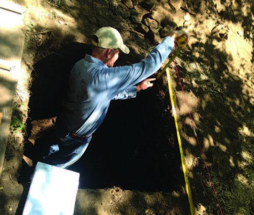
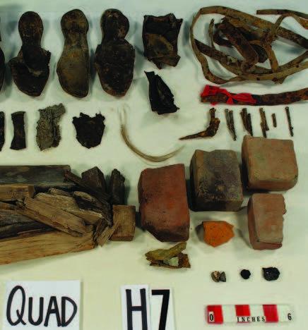
On Tuesday, August 29, 2017, the Ponderosa Fire began when an illegal campfire got out of control, eventually growing to 4,016 acres. Fifty-four buildings and structures were destroyed in the fire, including 32 homes and 22 outbuildings. As a fire suppresion effort, fire lines are often cut through the earth ahead of the burning fire. One of these fire lines cut and destroyed portions of an archaeological site designated as CA-BUT-3176.
CA-BUT-3176 is a Native American site that had never been formally evaluated, so there was only a partial understanding of what the site contained. After the fire the US Forest Service screened the cultural material that was displaced by the fire lines and identified dozens of flaked stone tools, groundstone fragments, steatite bowl fragments and many other artifacts. The site contained far more material than anyone had realized.
The ASC conducted fieldwork in July of 2018, excavating units both within the disturbed area and in damaged features. Planned activities include bringing all artifacts back to the ASC laboratory for cataloging and analysis, and completing a report documenting the damage assessment work and evaluation.
North Fork American River Fuel Break Project
Client: CAL FIRE
Location: Auburn/Colfax, Placer County, CA
The ASC conducted inventory for a fuel break project along the North Fork American River between Auburn and Colfax at the request of CAL FIRE. The fuel break project is designed to lessen the threat of wildfire to populated areas living along the interstate 80 corridor, west of the river. The project involves private property owners voluntarily making their parcels available, and is expected to be a multi-year effort. ASC crews traversed about 768 acres on 19 private parcels. In general this was rugged and heavily overgrown terrain. Nevertheless, ASC field crews were able to identify 37 new cultural resources, and revisited three previously recorded ones. These resources will be protected during fuel break activities. Some areas were too overgrown to adequately inspects, so ASC recommended a return visit following vegetation removal, particularly in areas of controlled burning.
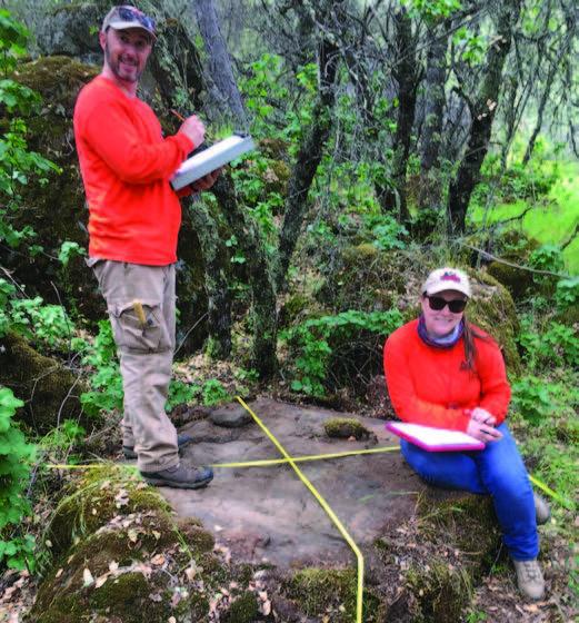
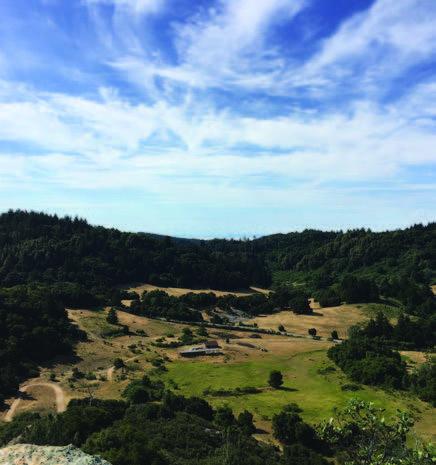
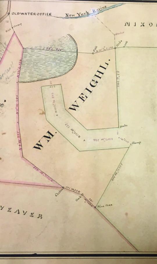
Van Norden Meadow Environmental Restoration Project
Client: South Yuba River Citizens League (SYRCL)
Location: Summit Valley, Norden, Nevada and Placer Counties, CA
The ASC completed cultural resource studies for an environmental restoration project at Van Norden Meadow, located in Summit Valley, at the top of the Sierra Nevada mountain range, for South Yuba River Citizens League (SYRCL), a non-governmental group working to restore the health and vitality of the Yuba River watershed. SYRCL is seeking to restore the meadow after the lowering of Lake Van Norden, a historic but antiquated reservoir, by filling incised channels and other alterations. The meadow is part of Tahoe National Forest, so restoration requires compliance with Section 106. ASC contacted tribal representatives, conducted a records search, surveyed about 380 acres, and assessed the valley for buried archaeological sensitivity. We found the meadow has a high density of prehistoric and historic-era cultural resources, which ring the meadow, and that the valley soils have a high potential for buried prehistoric remains.
Plunkett Training Site
Client: CAL FIRE
Location: Spanish Flat, Napa County, CA
The ASC collaborated with CAL FIRE staff to conduct an archaeological resources survey of the approximately 250-acre Plunkett Training Center Site, Spanish Flat, Napa County, California. The proposed Vegetation Management Project will include training exercises for inmate hand crews that include proper brush cutting, piling, burning techniques, and creating fire lines using hand tools. The pedestrian archaeological survey did not identify any archaeological resources in the project area.
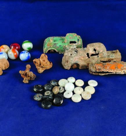
717 Battery Street/CA-SFR-186H Collection
Client: MBX Partners
Location: San Francisco, CA
in 2015, approximately 170 boxes of artifacts and dozens of oversize items associated with CA-SFR-186H in San Francisco, California, were transported to the ASC lab. The materials were recovered during excavations for the 717 Battery Street Project, which involved renovation of the existing 1907 Musto Building and new construction within the Musto Building Plaza. The project site is situated at the edge of historic-period Thompson's Cove on San Francisco Bay. The collection contains artifacts from 25 cultural features dating to the mid- to late-19th century, including materials that appear to date to the earliest periods of San Francisco's development as a city. Over the past several years, ASC staff have prepared the collection for curation, photodocumenting preishable items, upgrading packaging materials, and selecting artifacts for potential use in interpretive displays. The preparation process was completed this year, and the collection will be permanently curated at the David A. Fredrickson Archaeological Collections Facility.
Modeling Environmental Change Effects to Coastal Historic Landscapes and Cultural Resources, Point Reyes, California
Client: National Center for Preservation Technology and Training (NCPTT)
Location: Point Reyes National Seashore, Marin County, CA
The ASC, in coordination with the Point Reyes National Seashore (PRNS), completed a 3D photorealistic modeling project, in FY2017-2018, to understand and re-create visualizations of the shoreline and the prior and future effects of environmental change near Point Reyes, California. The project models the evolution of sea level, changing plant communities, erosional dynamics, and effects on ecosystems over the last 18,000 years, and projected for the next 2,000 years into the future. The technology used included LiDAR datasets modified in ArcGIS and imported into Terragen 4.0, a photorealistic scenery generator.
The project deliverables include low earth orbit animations over the entire time span, along with ground-level visualizations set during specific periods that convey an immersive sense of the PRNS as it existed in the past, and as it may exist in the future given the various models for sea level rise and climate change projected for the California Coast. The project was completed at the end of the 2018 Fiscal Year, but outcomes related to future management of historic landscapes, as well as public education and interpretation for the National Park Service are still underway.
North Bay Fires Cleanup
Client: Environmental Chemical Corporation
Location: Sonoma, Napa, & Mendocino Counties, CA
During November and December 2017 and January, February, March, April, May, and June 2018, the Environmental Chemical Corporation (ECC) and its subcontractors removed debris and contaminated soils from residential properties in Sonoma, Napa, and Mendocino Counties that were affected by the numerous wildfires of October 2017. ECC performed this work at the request of the United States Army Corps of Engineers (USACE) and the California Governor's Office of Emergency Services (CalOES) working in cooperation with the Federal Emergency Management Agency (FEMA). The ASC at Sonoma State University monitored these activities for archaeological resources.
ASC archaeologists coordinated and worked alongside Tribal representatives to monitor at all known site locations and to survey properties that could be considered sensitive. The Middletown Rancheria was given the lead on this project and coordinated with the tribes of Sonoma, Mendocino, and Napa to protect Tribal cultural values. In some cases, Middletown Rancheria acted as a placeholder for other tribes, assisting them as monitors, while in other cases, other individual tribes provided their own monitors. In Sonoma County this included Lytton Rancheria, Federated Indians of Graton Rancheria (FIGR), and Cloverdale Rancheria. In Mendocino County this included Coyote Valley, Round Valley, Sherwood Valley, and Redwood Valley. In Napa this included the Mischewal Wappo.
From November 2017 to June 2018 ASC archaeologists monitored ground disturbing activities at 27 properties in 2017 and 60 in 2018 and surveyed 62 properties in 2017 and 238 in 2018. Four new archaeological sites were identified in 2017 and 13 sites in 2018. The ASC and Tribal representatives were successful in protecting cultural resources while minimizing delays to the cleanup of resident's homes.
Malakoff Diggins - North Bloomfield Historic District Environmental Restoration Project
Client: Department of Parks and Recreation
Location: Malakoff Diggins State Historic Park, Nevada County, CA
The ASC has devoted over five years of inventory efforts of Malakoff Diggins State Historic Park with field survey and site record development. California Department of Parks and Recreation is inventorying the entire 5,000-acre Park ahead of a large restoration project under consideration that may have impacts to the Historic District's cultural resources. The park is famous for its well-known Malakoff Hydraulic Mine Complex of the North Bloomfield Gravel Mining Company. It is the best known hydraulic mine in the world and on the National Register of Historic Places as the Humbug Diggins - North Bloomfield Historic District. Several other large hydraulic mines and many smaller ventures are scattered throughout the Park. The mining settlements of North Bloomfield, originally known as Humbug City, Lake City, and Derbec, as well as forgotten mine camps and cabins, are also present punctuated by ditches, roads, and prospects in this one of a kind mining landscape. The park also contains a rich prehistory, evidenced by several sites dating back to the Middle Archaic period, as well as the remains of the historic-era Native American neighborhood of town, known as the North Bloomfield Campoodie. Survey efforts have completed, and evaluation studies are nearing finalization.
Locatelli Ranch
Client: CAL FIRE
Location: Boulder Creek, Santa Cruz County, CA
The ASC conducted an archaeological resources study of the 157-acre Locatelli Ranch near Boulder Creek, Santa Cruz County. The Locatelli Ranch Vegetation Management Plan project includes cutting lines by hand and bulldozer and prescribed burning with pre-treatment of brushy areas by bulldozer high-blading, bulldozer ball-and-chaining, or using a brush masticator. The pedestrian archaeological survey relocated one previously recorded site in the project area, P-44-000095 (CA-SCR-000091), and the crew prepared updates to the site record forms. The survey also recorded one previously unindentified site, ASC-3217-02.
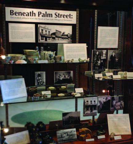
Palm Street Chinatown Collection
Client: City of San Luis Obispo
Location: San Luis Obispo, San Luis Obispo County, CA
In 2014, more than 220 boxes of artifacts associated with the Palm Street Chinatown Site (CA-SLO-64H) in San Luis Obispo, California, were transported from the City of San Luis Obispo to the ASC lab. Since then, ASC staff and student employees have spent hundreds of hours cleaning, organizing, and repackaging the collection in preparation for final curation at the San Luis Obispo County Archaeological Society (SLOCAS) facility, in addition to preparing technical and research reports, and public interpretation related to the collection.
Palm Street Chinatown Interpretive Products
Client: City of San Luis Obispo
Location: San Luis Obispo, San Luis Obispo County, CA
Several interpretive products were created for the City of San Luis Obispo focused on the history of Palm Street Chinatown. As part of her thesis work, graduate student Lauren Carriere, conducted background research, oral history interviews, and artifact analysis to develop an interpretive webpage for the City of San Luis Obispo's website, content for an interpretive panel, and created a display case exhibit using artifacts from the collection. The display case exhibit was installed in May 2018 and as of today is still accessible for viewing at San Luis Obispo's City Hall building.
Eureka Smelters Project and Remediation Monitoring
Client: Environmental Protection Agency
Location: Eureka, Eureka County, NV
The ASC devoted five years to monitoring EPA remediation efforts in the Eureka Historic District, a National Register Historic Distrinct in the Town of Eureka, Nevada. The town's boom period lasted from about 1870 to 1885 with numerous mills and smelters processing ore, some amid the area that is currently Eureka's residential and commercial districts. Smelter waste contamination, primarily lead and arsenic, is found throughout town.
The EPA is currently cleaning residential lots with the highest concentrations and those where children reside. ASC staff Mark Walker, Michael Stoyka, and Mike Konzak have surveyed and reported to the Nevada SHPO on over 179 parcels, identified over 76 archaeological resources, written 5 National Register evaluations, and completed over 43 reports over five field seasons. The work was conducted under a Finding of No Adverse Effect with conditions negotiated with SHPO by ASC in 2013.
San Juan Ridge Mine Historical Research
Client: San Juan Ridge Taxpayers Association
Location: North Columbia, Nevada County, CA
San Juan Ridge Taxpayers Association requested a cultural resources records search and historical research investigation into the approximately 1400-acre North Columbia Diggings property currently known as the San Juan Ridge Mine. The goal of the study was to improve understanding of historical mining and/or processing activities that took place at the site. The Tisdale brothers were among the frst to construct a log cabin at the headwaters of Spring Creek. The spot grew into the community of Columbia Hill. Mining at this time was localized and relied on relatively simple methods, and the miners still had little understanding of the geology. Prospectors exhausted the gold deposits that were easy to fnd during the 1850’s, with many moving on to other strikes by the close of the decade. The frst gold mining bust came by about 1858.
Claims were sold inexpensively by this time, or acquired by creditors to pay of debt. Many diggins were simply abandoned. Water played a major role in miners going bankrupt. Many small-scale operations purchased water on credit from the large water suppliers, such as the Eureka Lake Water Company, but failed to extract enough gold to pay their bills. In this manner, water companies began to acquire many failed claims. They sold, worked, and leased these properties as they saw ft. Mining Engineer, J. D. Hague, prepared a report in 1874 on the consolidated water and gravel properties belonging to the Eureka Lake and Yuba Canal Company Consolidated. Development came to a halt a decade later, however, when a federal court settled against mines dumping their waste into waterways.
W. F. Prisk summarized Columbia Hill at the close of the 19th-Century: “Like all the other ridge towns, Columbia Hill [North Columbia] is dull and quiet since its principal industry—hydraulic mining—has been placed under the ban. Columbia Hill was settled early in the 50’s and has an interesting history. Here is located the famous Eureka Lake and South Yuba Canal Company’s mine, one of the largest on the ridge, and which has produced millions of dollars. The company owns an immense system of canals and ditches, at present not being used to any great extent."
Calistoga
Client: Caltrans
Location: Calistoga, Napa County, CA
In April and May of 2018 Caltrans installed ADA compliant curb ramps in 12 locations in the city of Calistoga. Bryan Mischke and Michael Stoyka monitored six curb locations where ramp construction excavation occurred within three previously recorded archaeological sites: CA-NAP-480, CA-NAP-943/H and CA-NAP-1128/H. Project excavation was shallow; however, two intact portions of CA-NAP-480 and CA-NAP-943/H were recorded during monitoring. Artifacts collected during monitoring are curated at the David A. Fredrickson Archaeological Collection Facility.
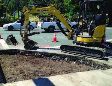
455 Fell St.
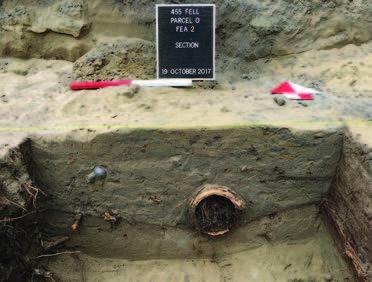
Client: Caltrans
Location: Calistoga, Napa County, CA
In September and October of 2017 the ASC implemented an Archaeological Testing Plan for “Parcel O” at 455 Fell St. in San Francisco. Testing consisted of Geoprobe coring extraction and analysis for buried historic-era ground surfaces and buried A-horizon soil indicative a stable prehistoric ground surface. Mechanical testing of areas identifed in the cores confrmed the presence of historic-era ground surface. During mechanical excavation to clear fll from two areas within the parcel ASC personnel identifed two wood-lined historic-era privies. After excavating and recording the features in the feld, personnel processed and analyzed the artifacts at the ASC lab. Artifacts from Feature 1 are likely from from Moorhead family, Irish immigrants living on Fell Street from 1870-1875, and considered eligible for the CRHR. Geoprobe coring also identifed a deeply-buried A horizon that provided radiocarbon dates of 1445–1524 cal AD (505–426 cal BP) and 1558–1632 cal AD (392–318 cal BP). The coring did not yield evidence of human occupation, and no further treatment was recommended. Artifacts collected during monitoring are curated at the David A. Fredrickson Archaeological Collection Facility.